Data that lands clean in your system of record.
A deliverable your team has to re-project, re-name, and re-organize isn't a deliverable — it's a task. We scope CRS, formats, and structure up front, so point clouds, surfaces, and models arrive ready for your geodatabase or design environment.
Capture runs on pre-planned flight lines with RTK-corrected positioning, documented on every pass. You get the data and the documentation behind it.
The full data stack.
- ✓Textured 3D mesh models
- ✓Point clouds (LAS/LAZ)
- ✓DSM / DTM elevation surfaces
- ✓Stockpile & cut/fill volumetrics
- ✓CRS-matched exports
- ✓Capture & QA documentation
Processed through industry-standard photogrammetry workflows and delivered organized — with the documentation your QA process expects.
- GIS departments — current, CRS-correct data for the system of record without a field crew.
- Civil engineers — existing-conditions surfaces, elevation data, and site context for design.
- Construction & materials teams — stockpile volumetrics and earthwork tracking on a cadence.
- Asset managers — navigable 3D records of facilities and infrastructure as they actually exist.
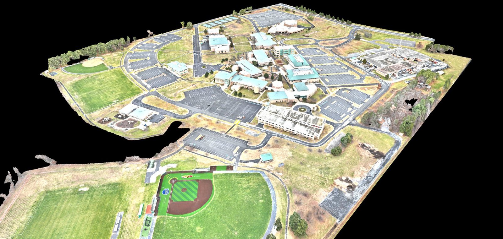
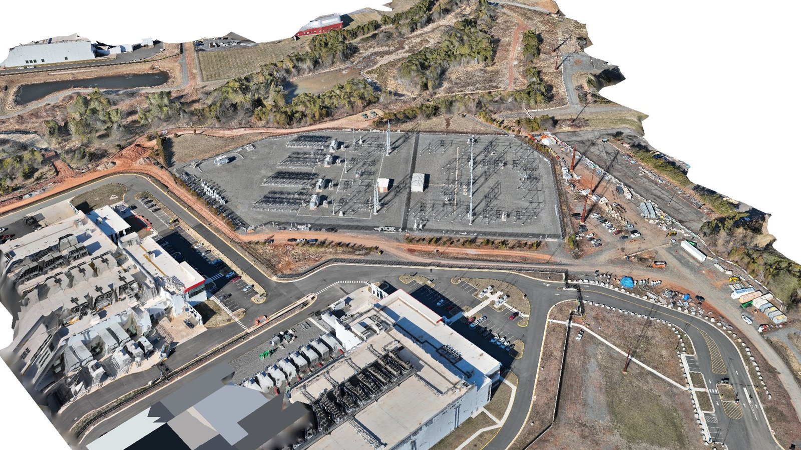
Models and surfaces from real sites.
Recent data work includes a navigable textured 3D reconstruction of a data center and substation in Prince William County, a color-mapped digital surface model for volumetric analysis in Loudoun County, and a full textured mesh of a multi-building institutional campus in Frederick, MD.
Data products, straight answers.
Can you match our coordinate reference system?
Yes. Tell us your CRS and datum requirements during scoping and deliverables arrive matched to them — built to land in your file geodatabase or design environment without re-projection on your end.
What formats can you deliver?
Point clouds (LAS/LAZ), textured mesh (OBJ and common 3D formats), GeoTIFF rasters for DSM/DTM and orthos, plus KML/KMZ overlays. If your workflow needs something specific, ask — format flexibility is part of scoping, not an add-on.
How is capture quality controlled?
Flights run on pre-planned lines with RTK-corrected positioning, and every pass is documented. Relative accuracy of roughly 2 cm is achievable depending on site conditions and requirements — and we're straightforward about what your site and use case support before we fly.
Can you do volumetric calculations?
Yes — stockpile and cut/fill volumetrics from elevation data are a standard deliverable for construction and materials teams, delivered with the surfaces they were measured from so your engineer can verify the numbers.
What does a data engagement cost?
Scope drives it: site size, deliverable set, accuracy requirements, and cadence. Send the requirements and you'll get a straight answer on scope, timeline, and cost within one business day.
Need mapping, inspection, or imaging instead? See all four services →