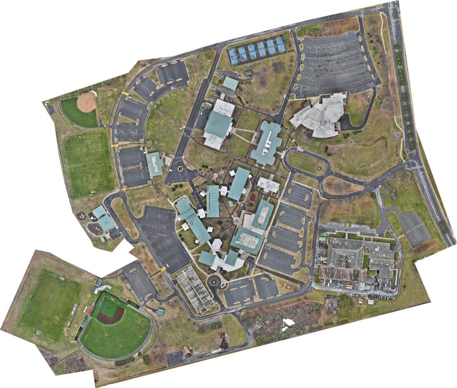
Mapping & Orthomosaics
Accurate, high-resolution maps and stitched aerial imagery for planning, documentation, site analysis, and progress tracking. One clean overhead view of the whole site — measurable, repeatable, and ready for your system of record.
Construction PMs, general contractors, land developers, surveyors, and GIS teams who need decision-ready site data.
- ✓Orthomosaic maps
- ✓Site & survey maps
- ✓Progress documentation
- ✓High-res stitched imagery
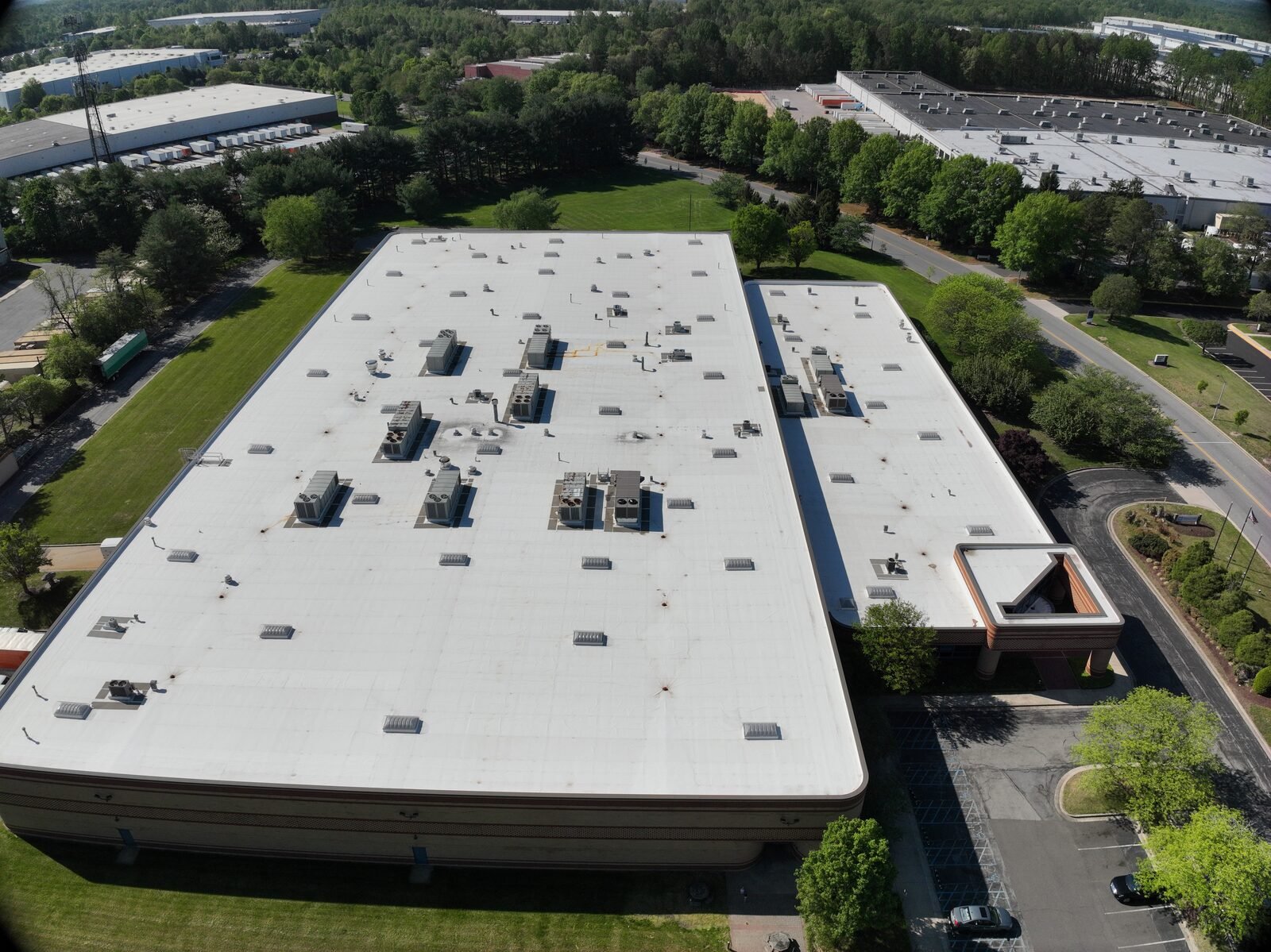
Aerial Inspection
A safer, faster, more efficient way to inspect roofs, structures, infrastructure, and hard-to-reach assets. Get a complete, documented view of elevated and difficult areas — without ladders, lifts, or shutting down the site.
Facility & property managers, roofing contractors, utilities, and insurers who need condition data without the risk.
- ✓High-resolution imagery
- ✓Condition documentation
- ✓Elevated-area visibility
- ✓No lifts or ladders
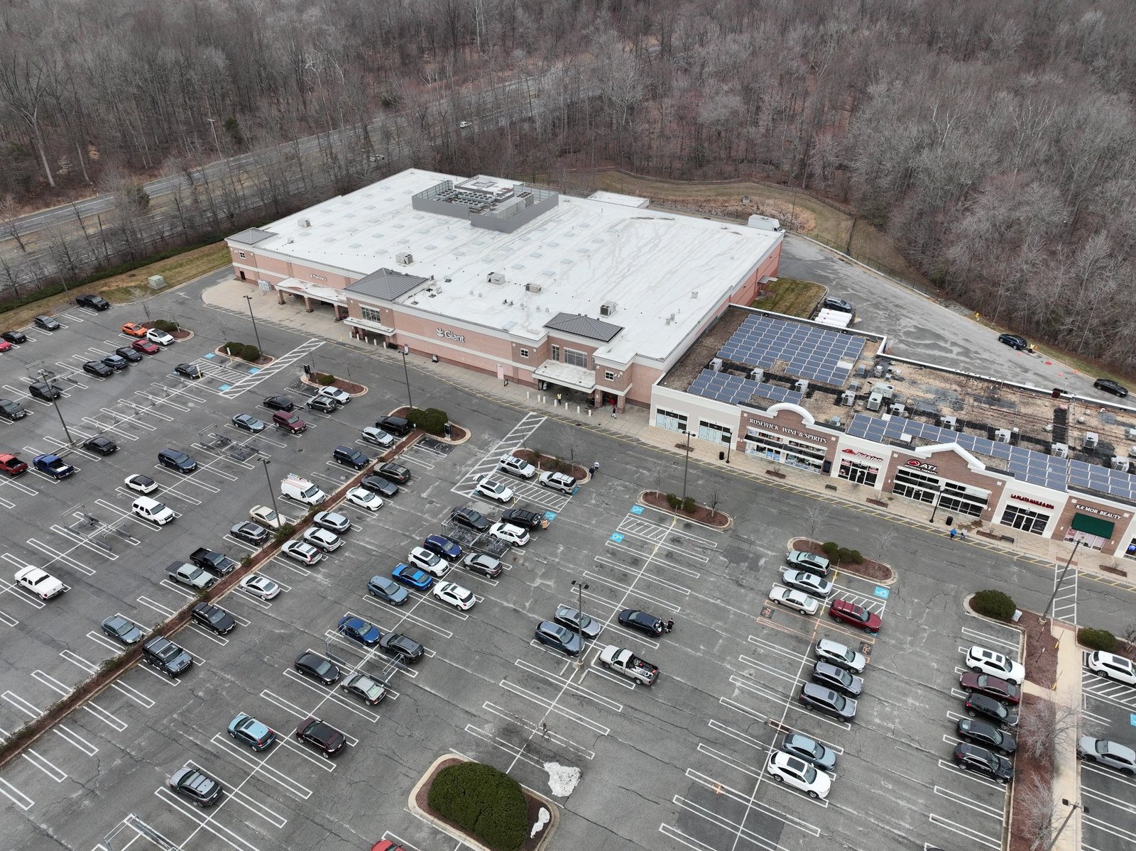
Aerial Imaging
High-quality visual content for properties, construction projects, marketing, real estate, and storytelling. Cinematic, owner-ready imagery and video that makes the project look as serious as the work behind it.
Marketing teams, real estate professionals, developers, and GCs who need professional visuals on brand and on time.
- ✓Aerial photography
- ✓Aerial video & flyovers
- ✓Property & marketing visuals
- ✓Construction progress media
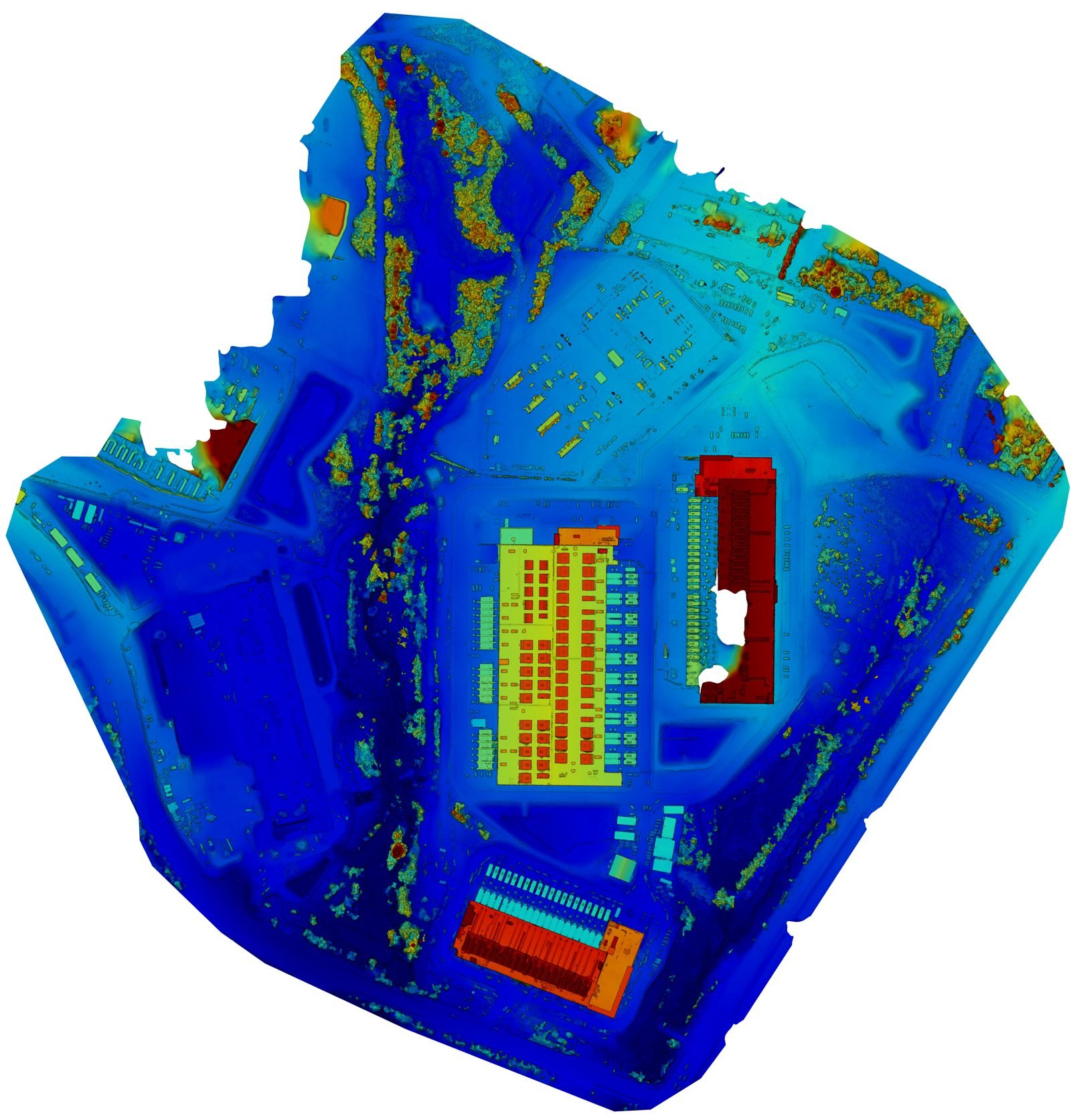
Professional-Grade Data Products
Advanced deliverables for teams that need more than photos and video. Processed datasets, measurement-ready imagery, and decision-support visuals — organized, documented, and built to drop straight into your tools.
GIS departments, civil engineers, and asset managers working with CRS, elevation, and measurement data.
- ✓Processed datasets
- ✓3D models & elevation
- ✓Measurement-ready imagery
- ✓Reporting & decision support