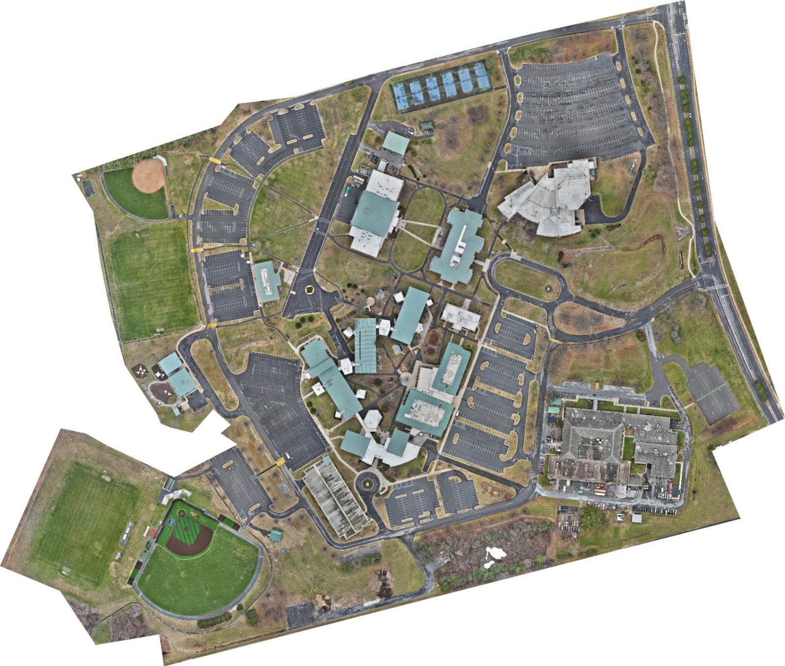
A site walk shows you one angle. A map shows the whole story.
Progress claims, earthwork disputes, planning questions — they all come down to what you can prove. An orthomosaic is one stitched, to-scale overhead view of your entire site. Flown on the same lines every cycle, it turns week-to-week change into measurable progress instead of guesswork.
Flights run on RTK-corrected positioning with pre-planned, repeatable flight lines. Relative accuracy of roughly 2 cm is achievable depending on site and requirements — and we'll tell you up front what your use case supports.
Deliverables that drop straight into your workflow.
- ✓Orthomosaic maps (GeoTIFF + JPG)
- ✓Site & planning maps
- ✓KML/KMZ overlays
- ✓Progress documentation on a cadence
- ✓High-res stitched imagery
- ✓Elevation & measurement exports on request
Every delivery is organized, date-stamped, and owner-ready — a package you can forward as-is, without rewriting anything.
- Construction PMs & GCs — progress tracking, earthwork documentation, owner updates before the OAC meeting.
- Land developers & surveyors — current-conditions basemaps and planning imagery for sites that change fast.
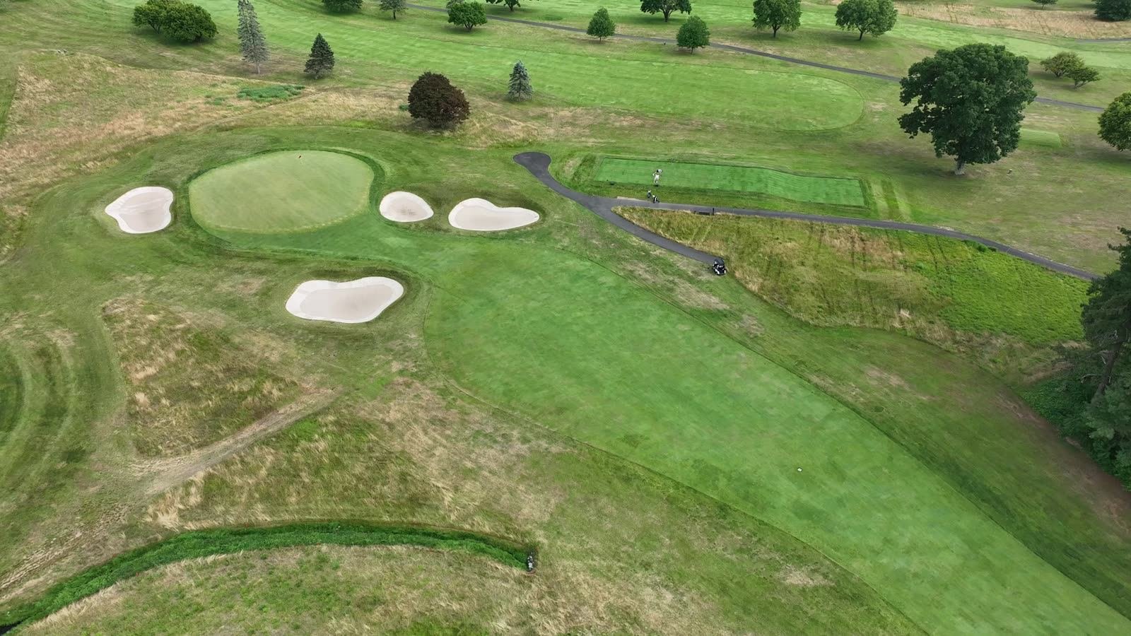
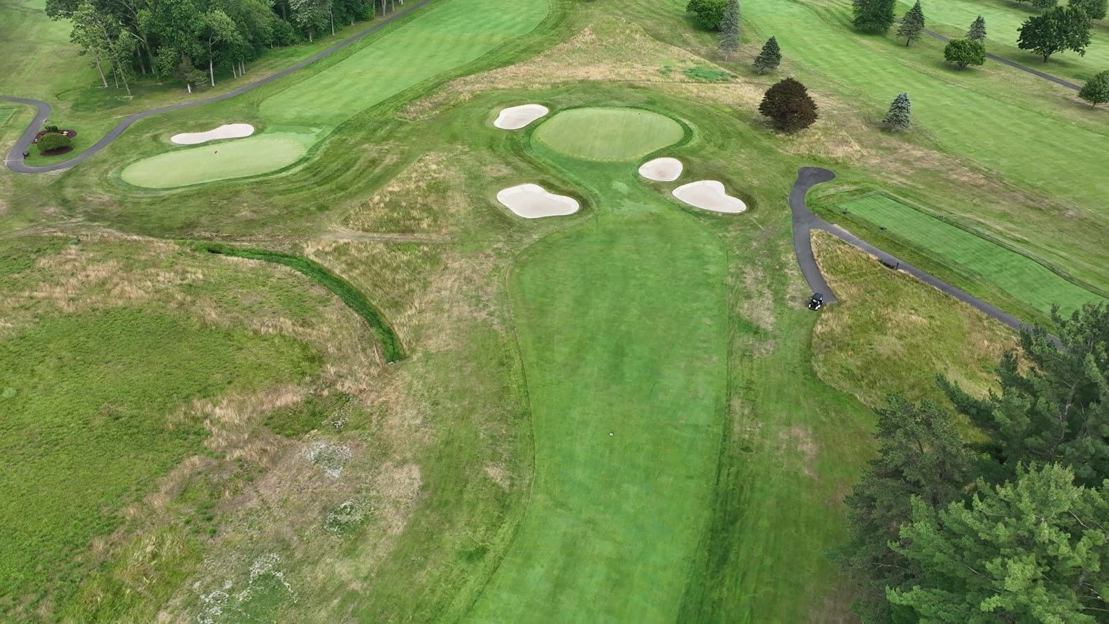
- Golf & turf teams — per-hole, repeatable capture for turf health, drainage, and grounds planning.
- GIS departments — CRS-aware exports built to land cleanly in your system of record.
Two courses. One day. 5,800+ RTK-tagged images.
Golf Club of Avon, Connecticut — a full mapping engagement across the club's Red and White courses. Every hole and green flown on its own pre-planned flight line, so the next capture is directly comparable to this one. That's the S.I.T.E. Method working: scope it once, repeat it forever.
Also in the portfolio: recurring orthomosaic cadence over an active hyperscale data center site in Loudoun County, VA. View portfolio →
Every map runs on the S.I.T.E. Method.
Scope
Site, goal, timeline, airspace — and flight lines planned before we leave the office.
Inspect
RTK-corrected capture on consistent lines, fully documented on every pass.
Track
Same lines every cycle, so each map is directly comparable to the last.
Export
Organized, owner-ready delivery in the formats your team already uses.
Drone mapping, straight answers.
How accurate are the maps?
Flights run on RTK-corrected positioning, and relative accuracy of roughly 2 cm is achievable on mapping deliverables depending on site conditions and requirements. We'll tell you up front what your site and use case support. For boundary or legal surveys you still need a licensed surveyor — our maps complement that work, they don't replace it.
What file formats do I get?
Standard deliveries include GeoTIFF and high-resolution JPG orthomosaics, plus KML/KMZ overlays. Elevation data, point clouds, and CRS-matched exports are available for teams that need them. Everything is organized to drop into the tools you already use.
How fast is turnaround?
Typical turnaround on processed mapping data is 48 hours from flight. Recurring progress cadences are scheduled so data lands before your owner meetings, not after.
What does drone mapping cost?
Pricing is scoped per site — acreage, deliverables, and cadence drive the number. Tell us about the project and you'll get a straight answer on scope, timeline, and cost within one business day.
What areas do you serve?
We're based in Centreville, Virginia and work up and down the Mid-Atlantic — recent projects span Virginia, West Virginia, Maryland, DC, and New Jersey, with regional engagements as far as Connecticut.
Looking for inspections, imaging, or 3D data instead? See all four services →